I am very happy to have a talk accepted at FOSDEM in the geospatial track. My first ever complex program was drawing a map of belgium in Logo, and FOSDEM is one of the biggest conference for open source software, so this kinda feel like the achievement of a very long process :-)
I’ll update this post with a link to the FOSDEM site when it is updated, but in the mean time, here is the abstract of what will be a 45 minutes recorded video presentation followed by a Q&A:
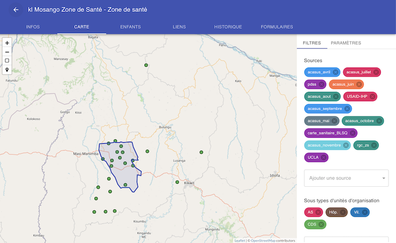
Iaso is a platform created to support geo-rich data collection efforts, mainly in public health in emerging countries. The key feature that it supports is that any survey is linked to an organizational unit that is part of a canonical hierarchy. Each one of these org units can have a location and a territory. The mobile data collection tool can be used to enrich this hierarchy with additional GPS coordinates, names corrections, etc. which can then be validated by officials of the organizations in question through the web dashboard. This leads to continuous improvements of the geographic references available through the routines activities already planned (e.g. locating and registering health facilities while investigating malaria cases).
The tool has been used in multiple data collection efforts, notably in the domain of Performance Based Financing of health services in D.R. Congo, Niger, Cameroon and Nigeria and is more and more used to compare multiple version of official organizational hierarchies when a canonical one needs to be rebuilt. We are for example working on such efforts to rebuild a school map for DRC with the NGO Cordaid. To help for this type of project, we provide location selection interfaces, multiple levels of audits and an API open to data scientists for analysis and mass edits.
This presentation will demo the main features of the platform, and give some context about its creation.